Ajax Gamma 3D Ground Scanner
Ajax Gamma – Professional 3D Ground Scanner & Metal Detection System
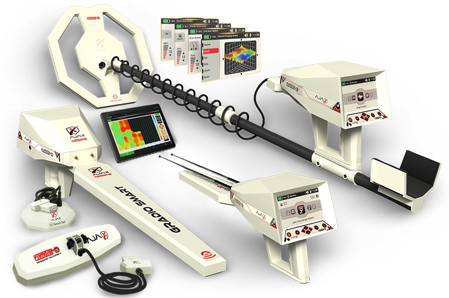
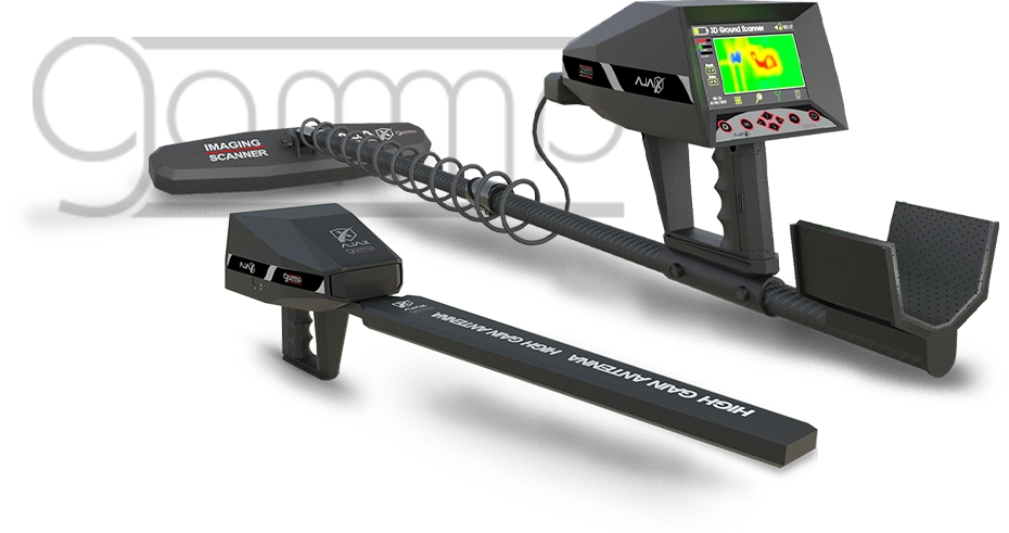
The Ajax Gamma is a professional multi-system ground scanning and detection device designed to support the search and analysis of metals, gold-related targets, and underground voids.
Combining multiple detection technologies within a single platform, Gamma provides users with versatile tools for ground surveying and subsurface exploration. Its integrated scanning functions are designed to collect and display ground data in different formats, helping the operator evaluate signals and identify areas that may require further investigation.
The device features a 5-inch high-resolution color display with an intuitive interface that provides direct access to scanning functions, system settings, and search parameters. Operators can configure the available functions according to the selected detection system and the conditions of the search area.
Three Integrated Search Systems
Ajax Gamma combines three specialized systems:
- Gradiosmart System
- Live Scan System
- 3D Ground Scanner System
Each system provides a different approach to ground scanning and target investigation, allowing the operator to select the method best suited to the specific search task and site conditions.
Advanced Design & Key Features
The Ajax Gamma combines three specialized ground scanning and detection systems within a modern, integrated platform. Its ergonomic design, intuitive controls, and responsive system interface are developed to provide a smooth and efficient experience throughout different search and surveying applications.
Designed with portability and practical field use in mind, Gamma features a lightweight and user-friendly construction, allowing operators to configure the device, manage scanning functions, and review collected data directly from the main interface.
Purpose-Built Design
The Gamma has been developed and manufactured by Ajax Detection Technology, with its hardware and system components engineered to work together as an integrated platform. This approach supports consistent system operation, reliability, and efficient communication between the device and its search sensors.
Its robust construction is designed for demanding field conditions and to help reduce the influence of environmental interference during operation.
5-Inch Color Display
A 5-inch high-resolution color display provides clear access to system settings, scanning functions, search parameters, and collected data.
The intuitive software interface allows users to navigate between functions and adjust available settings according to the selected search system.
Practical Power System
The main battery is integrated into the device's carrying handle and can be accessed without opening the main device housing, making battery replacement simple and convenient.
Under specified operating conditions, the main battery provides up to 5 hours of continuous operation. An optional external power bank can extend the total operating time to up to 10 hours, depending on device settings and operating conditions.
Audio & Charging Connectivity
A dedicated headphone output allows users to receive device alerts and audio feedback clearly during operation.
The charging connection supports compatible charging equipment designed for efficient battery charging and reliable everyday use.
Multi-System Sensor Connection
The dedicated search-system input enables compatible Gamma sensors and scanning accessories to be connected or removed quickly. Its mechanical connection system is designed to provide secure installation while allowing convenient switching between supported search configurations.
Control Interface
The physical button interface provides direct control over the device's programs, settings, and on-screen functions. The control area is designed with field operation in mind, providing a practical interface for use during scanning and exploration.
The Gradiosmart System is designed to measure and visualize variations in the surrounding magnetic field, supporting the investigation of subsurface anomalies that may be associated with metallic objects, voids, mineralized areas, and other changes in ground conditions.
Unlike conventional surveying configurations that may require larger equipment, the Gradiosmart System combines its sensing technology with the Gamma's integrated control and analysis interface, providing a practical solution for field scanning and data evaluation.
Advanced Magnetic Sensing
The system operates through a dedicated sensing unit equipped with high-sensitivity vector-guided sensors. These sensors measure variations in the magnetic field and transmit the collected data to the Gamma for processing and visualization.
Based on the measured response, the system assists the operator in evaluating magnetic anomalies and distinguishing between different signal patterns. Final interpretation depends on factors such as target properties, soil composition, mineralization, environmental interference, and operating conditions.
Intelligent Search Interface
The high-resolution interface provides direct control over the available search parameters and system settings, allowing the operator to configure the system according to the survey conditions.
The results interface provides:
-
Signal-strength indicators for measured anomalies
-
Oscilloscope-style visualization of signal responses
-
Interactive digital indicators to assist with signal interpretation
-
Optional acoustic and vibration feedback
Ground Balance
The Gradiosmart System includes manual and automatic ground balance functions designed to compensate for magnetic effects caused by surrounding soil conditions and improve the stability of the measurement process.
Applications
Depending on site conditions and the characteristics of the target, the Gradiosmart System can support surveying applications involving:
-
Metallic objects
-
Underground voids and cavities
-
Mineral exploration
-
Archaeological surveying
-
Pipes, cables, and other buried utilities
-
Surveying for potential metallic anomalies
Technical Specifications
Feature Specification Measurement Range ±20 to ±1000 µT Sensor System High-sensitivity vector-guided sensing unit Audio Feedback Optional acoustic and vibration feedback Digital Indicators Interactive signal-response indicators Ground Balance Manual and automatic Results Display Signal-strength and oscilloscope-style visualization -
The Live Scan System provides real-time ground scanning and visualization directly on the Gamma's integrated display, without requiring an external screen or separate visualization software.
The dedicated Live Scan interface processes and displays scanning data as it is collected, allowing the operator to observe signal responses and subsurface anomalies while moving through the search area.
Real-Time Ground Visualization
The system provides a dynamic visual representation of the scanned area directly on the device screen. Detected signal variations are displayed in real time, helping the operator identify areas and anomalies that may require closer investigation.
Depending on ground conditions, target characteristics, environmental interference, and system configuration, the displayed data can assist the operator in evaluating potential metallic and cavity-related anomalies.
Two Scanning Configurations
The Live Scan System supports two specialized scanning configurations:
-
Longitudinal Multi-Task Scanner – designed for focused scanning and detailed investigation of selected areas.
-
Multi-Radar Cross-Section Scanner – designed to collect scanning data across wider areas and support efficient field surveying.
These configurations allow the operator to select the scanning method that best suits the search area and survey requirements.
Adjustable Scanning Speed
The scanning speed can be adjusted according to the operator's walking pace and movement during the survey. This provides greater control over the scanning process and helps maintain consistent data collection.
Manual & Automatic Ground Calibration
The system provides both automatic and manual calibration.
Automatic calibration adjusts the system reference according to the operating conditions, while manual calibration allows experienced users to configure available parameters according to the characteristics of the search area.
Pause & Resume Function
The scanning process can be paused when required and resumed without restarting the complete scan configuration, providing greater flexibility during field operations.
Technical Specifications
Feature Specification Visualization Real-time ground scan visualization Scanning Configurations Longitudinal Multi-Task Scanner & Multi-Radar Cross-Section Scanner Operating Frequency Range Automatic, 50 MHz – 350 MHz Scanning Speed Adjustable according to operator movement Audio Feedback Optional acoustic and vibration feedback Digital Display Real-time visualization of measured signal responses and anomalies Ground Calibration Manual and automatic Pause / Resume Supported -
The 3D Ground Scanner System is designed to combine advanced ground scanning capabilities with an intuitive and user-friendly workflow. Its dedicated software interface gives the operator comprehensive control over the scanning process while presenting collected ground data in clear 2D and 3D visualizations for further evaluation.
The system offers two flexible ways to perform and analyze a ground scan: directly through the Gamma's integrated display or through a compatible Tablet PC using the Ajax analysis application.
Direct Ground Scanning
Ground scans can be configured and performed directly from the Gamma's display. The operator can define key scanning parameters, including:
-
Number of scan steps and lines
-
Scanning pattern and direction
-
Starting position
-
Automatic or manual scanning mode
Once configured, the scan data is collected and displayed directly on the screen, allowing the operator to review measured responses and identify areas or signal anomalies that may require further investigation.
2D & 3D Data Visualization
Collected scan data can be visualized in 2D and 3D formats, providing a more detailed representation of measured ground responses.
These visualization tools assist the operator in evaluating the position and characteristics of detected signal anomalies. Interpretation of the displayed data depends on factors such as ground conditions, mineralization, target properties, environmental interference, scanning technique, and system configuration.
Tablet PC & Ajax Analysis Application
For additional analysis options, the Gamma can communicate with a compatible Tablet PC via Bluetooth.
Using the Ajax analysis application, collected scan data can be examined with additional visualization and analysis tools, including detailed 3D representations of measured subsurface responses.
This provides users with the flexibility to perform scans directly from the device while using the tablet platform for more detailed post-scan evaluation.
Two Scanning Configurations
The 3D Ground Scanner System supports two specialized scanning configurations:
-
Longitudinal Multi-Task Scanner – designed for focused scanning and detailed investigation of selected areas.
-
Multi-Radar Cross-Section Scanner – designed for efficient data collection across wider survey areas.
The operator can select the scanning configuration according to the characteristics of the survey area and the requirements of the search.
Manual & Automatic Ground Calibration
The system provides both automatic and manual ground calibration.
Automatic calibration adjusts the system reference according to operating conditions, while manual calibration allows the operator to configure the available parameters according to the characteristics of the search area.
Technical Specifications
Feature Specification Primary Applications Evaluation of metallic and cavity-related anomalies Data Visualization 2D and 3D scan visualization Scanning Platform Integrated device display or compatible Tablet PC Connectivity Bluetooth connection for compatible tablet analysis Operating Frequency Range Automatic, 50 MHz – 350 MHz Scanning Configurations Longitudinal Multi-Task Scanner & Multi-Radar Cross-Section Scanner Scan Modes Manual and automatic Audio Feedback Scan-step and system notification alerts Ground Calibration Manual and automatic -
The Gamma device is designed and manufactured using strong yet lightweight materials, such as carbon fiber, to ensure durability and ease of transport. Its packaging is crafted from high-quality, dust-resistant, and humidity-resistant materials to protect the device.
- Ajax Bag
- Tablet
- Stick
- Imaging Scanner
- Gradio Smart Sensor
- Ajax Battery
- Power Adapter
- Headphone
Detection System multiple functions device containing 3 advanced and professional detection system Operating Principle Processing data and digital signals and converting them to visual and audible results Processor Architecture MIPS 32 Operation processor M4K™ Core Display Screen TFT Color LCD, 800 x 480 WVGA, 16-bit color depth Battery 7.4 volts, 3300 mAh Power Rating 400 mA Battery Endurance Typical usage time 10 hours Power Adapter 240-100 VAC / 15 VDC – EU Plug Storage 1 GB / it can save to 1000 scans. Sound High quality sounds, 32 KBIT/S, MP3 Notifications Sound and tactile feedback configurable in the settings menu for Bluetooth 2.4 GHz, sensitivity up to -80dBm. Languages Multilingual User Interface with support for 8 languages. Date and Time Real Time Clock could be set manually or automatically via GPS time. Login Restriction Configurable PIN. Overall Dimensions 88x53x20 cm Package Total Weight 7 kg Operating temperature From -10° C to 60° C (14° F – 140° F) Storage temperature From -10° C to 80° C (14° F – 176° F) Humidity Could be stored and operated at relative humidity level up to 90%.